Author: eiselane-admin

  • Blue Gold

    Blue and Gold World Water Wars

    Q: should water be privatized?

    Jim Olson (P) (environmental attorney)

    Aquifer (I)

    –              Underground natural reservoir

    –              Water goes through permeable rock (filters) until it hits impermeable rock

    –              You can access this water through water pumps or wells

    Atlantis

    –              Ubar, southern omar

    Recharge (I): groundwater filtered through natural means

    Desertification (I): growth of deserts around the world

    –              The lack of precipitation

    –              Deforestation

    –              Overgrazing

    –              No vegetation

    Permeable Pavement (explore for school project)

    Dam Rivers don’t carry nutrients down the stream, more erosion which leads to desertification

    May 11, 2026

    Slapsuit

    –              Strategic Lawsuit Against Public Participation) is a civil lawsuit filed to intimidate, silence, or censor critics by burdening them with high legal costs and, ultimately, exhaustion. These meritless cases are used by entities with superior resources—such as corporations or developers—against activists, journalists, and citizens to halt public discourse on matters of public interest

    Bi-local

    –              Trading with local regions

    –              Also good for environment

    A lot of water is being exported and depleting our lakes (aran sea).

    Deaths related to water

    –              Farmer in S-Korea

    –              Joanne, an activist who got assassinated for trying to protect a natural body of water.

    Countries and states are in conflict over water (war)

    –              Places like south Africa have a lot of aquifers, so many powers fight over them.

    Ways to address the water crisis

    –              Water available everywhere for everyone (to prevent privatization of water)

    –              Dig holes to trap water and revitalize the land

    –              Turbines in rivers

  • Age of Stupid

    Age of Stupid (2009)

    P. I. Q: categorize your notes!

    People (names of people, things that people say)

    Info (important pieces of information)

    Questions (any questions that come up)

    ·      The Archivist (P)

    o   Situated in the Arctic (alone) in an apocolyptic world.

    ·      Jeh Wadia (P)

    o   Trying to create India’s third low-cost airline.

    o   Trying to make flights as low as 1-600 rupees

    o   He’s trying to eradicate poverty by making flights cheaper, but in turn it contributes to global warming.

    o   Airplanes are one of the biggest contributors to global warming. Fuel and carbon emissions. Contrails

    ·      Fernon (P)

    o   A mountain guide in Chamonix, France (near Alps)

    o   Completed his training in 1956

    o   Meets Piers (P) and his family to climb the mountain

    o   The glacier that they wanted to see has melted. Fernon notes that the temperature has changed over the years.

    o   An empty gap where the glacier used to be.

    o   Fernon feels that there’s only two seasons.

    o   He admits that much of the world’s problems are caused by his generation. All in the name of progress.

    o   Protests against the doubling of the highway (“pointless transport trucks”)

    ·      Alvin (P)

    o   He experienced Hurrican Katrina

    o   Is from New Orleans, Lousiana (near Gulf of Mexico)

    o   “The intensity of storms is related to surface temperatures.” Heat = more energy.

    o   Alvin rescued over 100 stranded people on his little boat (and pets)

    o   He also works for Shell to search for more oil

    o   He admits to being a “classic consumer.”

    ·      Layefa (P)

    o   Wants to become a doctor and is approx 20-25 years old

    o   Situated in Nigeria

    o   Wants to build a facility, but construction stopped due to kidnappers (Boko Haram)

    o   Layefa’s sister died from cholera and it urged her to become a doctor

    o   She works as a fisherman

    o   How is it that this part of the world that produces so much oil, still have it’s community living in poverty (Q)? Ans: The resource curse. Resource rich  nations produces wealth that is only held in the hands of just a few (especially in developing countries). In turn, the population gets poorer and the rich become richer.

    o   Health problems from air polution. Lungs and skin diseases. From the burning of gases.

    o   She transferred to the diesel business because the fish business was declining. She needs the cash for college.

    ·      Jamila (P)

    o   From Iraq and left because of war

    o   Her and her family are refugees living in Jordan

    o   Jamila and Adnan’s father were killed in the war by American soldiers

    o   Jamila’s family buy unwanted shoes, repair them, and resell them

    o   Has an older bother named Malik. He got burned in a bombing because of his nylon clothing. He was not allowed to cross the border with the rest of his family

    ·      Adnan (P) Jamila’s brother

    ·      Mark Linus (P)

    o   Scientist and writer

    o   The effects of climate change won’t be seen until 2-3 decades later (too little too late kinda thing)

    o   According to Mark, human beings are adaptable to immediate danger.

    o   Mark and other scientists are warning about a “tipping point.” This is about 2 degrees higher than pre-industrial age. Once we have past the tipping point, we will not be able to recover, and it will accelerate the rise in temperature.

    o   Carbon capture (removing carbon and other greenhouse gases from the air)   

    ·      “People tend to get swept along with the predominant mindset/ideas, which has led to history’s greatest mistakes (holocaust, etc)”

    ·       Piers (P)

    o   Builds wind turbines

    o   “No single alternative can provide the final solution to the problem”

    o   He’s trying to build a wind farm near his home

    o   NIMBY: Not in my backyard. People are in support of the idea, but they don’t want it in their area.

    §  Argument #1: “least windy side of the country” (but the video clearly shows the wind blowing strongly)

    §  Argument #2: “It’s going to affect the view” (decrease property value)

    §  #3: “too much noise pollution”

    §  #4: “hypnotic and may distract drivers”

    o   Piers is going to make a sales pitch in order to stop the NIMBYs. He lost.

    o    

    ·      The neighbours have started to send threats to Piers to stop the wind farm construction.

    ·      The Global Cap (I):

    o   All remaining fossil fuel

    o   The solution involves many countries agreeing (binding)

    o   By 2065, the emissions will be close to zero

    o   Year 1: not much change

    o   After year 1: the biggest users will have a decrease in emissions, but the smallest users would increase their allowed emissions (so, they would agree to sign on and start developing)

    o   Eventually, everybody will have equal access to consumption of fossil fuels.

    o   After equality, everybody will decrease at the same rate.

    o   Carbon rationing.

    o   Eventually everyone/all countries will have a similar carbon “allowance.”
  • Strip The City

    San Francisco is sitting on a “tectonic time bomb”

    –              Two major earthquakes that destroyed the city (1906, 1989)

    Trans-America Pyramid

    –              Was the tallest skyscraper in the city

    –              Use: a commercial building (office workers)

    –              The design of the building to strengthen structure

    –              Steel skeleton (flexibility)

    –              Low centre of gravity (stability)

    –              Wide base, narrow top

    –              Pyramid shape

    –              Reiforced tress at the bottom

    –              Deep foundation of concrete (more stability)

    –              Additional features (that save lives)

    –              Seismic switch (sense the shaking and stop elevator)  

    Golden Gate Bridge

    –              Foundation deep enough to reach bedrock (stability)

    –              2 towers that help with flexibility

    –              Concrete blocks/anchors on either side of the bridge stability)

    –              Steel cables that are connected to the anchors

    –              Each cable is made up of separate/ a bundle of steel wires (strength)

    Oakland Bay bridge

    –              Features:

    –              Cables made of separate steel wires (swing freely

    –              Central tower made up of four pylons.

    –              Beams that crumple to absorb/disperse the force of the earthquake

    –              Roadway is made up of several pieces

    –              Hydraulic joints the provides flexibility and dispersement of force

    Mission Bay

    –              Muddy land

    –              Features

    –              Very long foundation piles so it hits bedrock (stability)

    –              Concrete caps placed on top of piles to increase surface area

    –              Concrete beams

    –              Concrete matts

    Central Subways Tunnels

    –              Features

    –              Tunnel made in segments for flexibility

    –              Steel mesh

    –              Tunnels made of concrete (strength)

    –              Lined with rubber (flexibility)           

  • Volcanoes

    Volcanoes

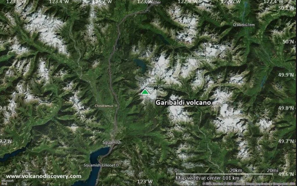
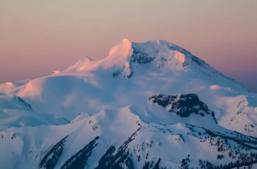
    Mount Garibaldi

    Current status: Dormant
    Location:

    –              Absolute: 49.8507° N, 123.0046° W

    –              Relative: 64–70 km north of Vancouver, BC, overlooking the town of Squamish. Situated in the heart of the Coast Mountains within Garibaldi Provincial Park, it is directly accessible via the Sea to Sky Highway (Highway 99) and is positioned between Squamish to the south and Whistler to the north.

    Last eruption was approximately 13,000 years ago

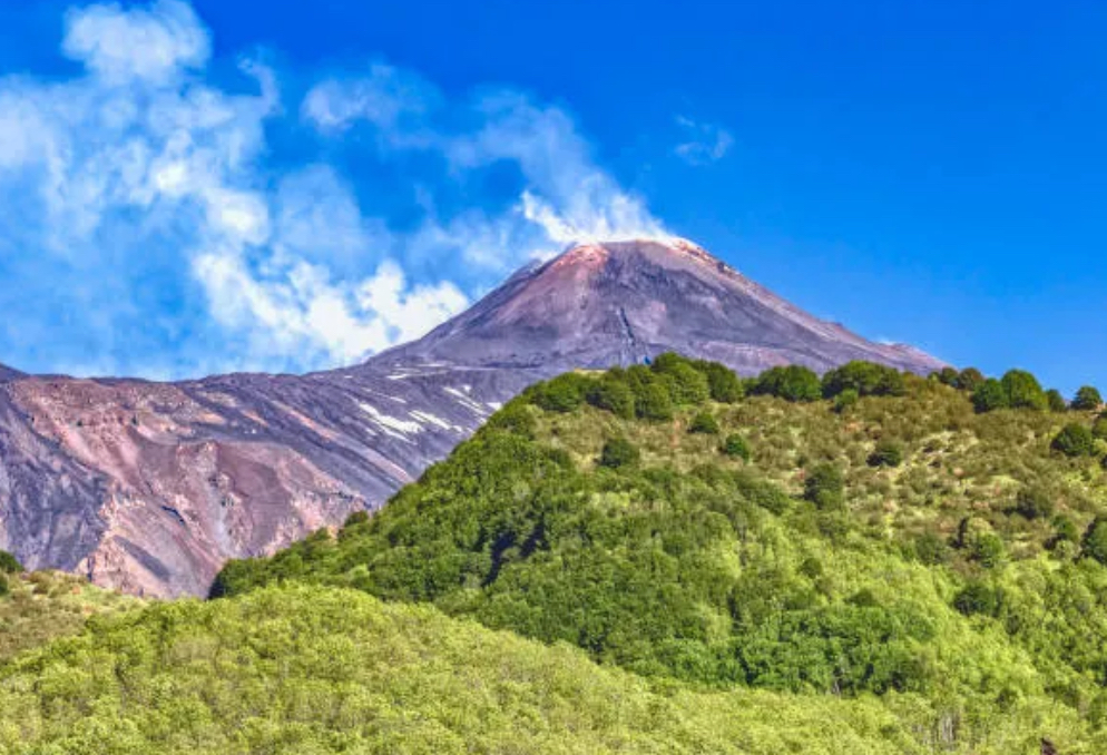
    Mount Etna


    Active since January 1, 2026

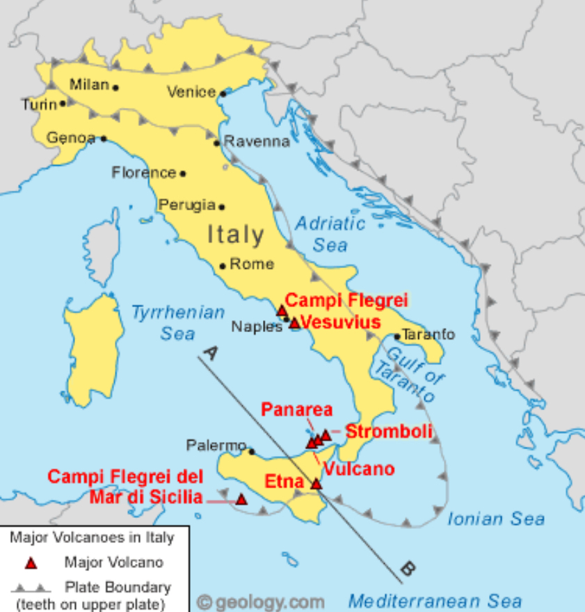
    Location:

    –              Absolute: 37.7518° N, 14.9947° E

    –              Relative: Mount Etna is located in Sicily, Italy, on the opposite side of the planet from Vancouver, BC, Canada, situated approximately 9,000–9,500 km (roughly 5,600–5,900 miles) northeast of Vancouver.

    Last eruption occured on June 2, 2025

  • Basics of Geography

    Weather: describes the current conditions

    Climate: Long term pattern of weather

    Factors that influence climate:

    –              The sun, it provides all the light and heat. Not all places receive the same amount of light due to the Earth’s rotation on it’s axis (day-night cycle).

    –              Revolution of the Earth (how long it takes to make one full circle around the sun). The tilt gives the Earth: seasons.

    –              Lattitude: the distance away from the equator. There are 5 lines of lattitude.

    –      Equator: 0.  The equator receives more sun than the other places further from it.

    –      Tropic of Cancer: 23.5 N.

    –      Tropic of Capricorn. 23.5 S.

    –      Anywhere located between T.o.Can and T.o.Cap are called the low lattitudes/tropics.

    –      Antarctic Circle: 66.5 S.

    –      Arctic Circle: 66.5 N.

    –      Areas between 23.5 and 66.5 are called the Middle Lattitudes. The sun never shines directly on those zones. AKA the Temperate Regions.

    –      Polar Regions/High Lattitudes are above 66.5 degrees north or south. They receive the least amount of sunlight.

    –              Elevation: height from sea level. Higher elevation = colder.

    –              Percipitation: when water vapour condenses and falls (rain, snow, hail, etc).

    –              Wind: air moving sideways from one place to another. Wind blowing from tropics = warm air. Wind blowing from polar regions = cold air.

    –              Like wind, water currents flow. But they are restricted by land. Water currents moderate temperature by carrying warmth.

    –              Gulf Stream

    Six Climate Regions:

    –              Tropical

    –              Sub Tropical

    –              Temperate

    –              Sub Polar

    –              Polar

    –              Highlands

    Climate zones are defined by two main things: Percipitation and temperature.

    –              Climate determines the type of architecture used in homes.

    Feb 18 notes (review last class notes later)

    –              Craton in South Africa (oldest rock on the planet)

    –              Granite is less dense than most other rocks in the Earth’s mantle

    –              Pillow lava: formed under the sea when lava from underneath hits the cold water.

    –              The crust is made of tectonic plates (like a jig-saw, constantly moving)

    –              The tectonic plates float on top of the mantle (semi-solid layer).

    –              Continental Drift (1912 theory trying to explain why the tectonic plates move).

    –              Identical fossils found in seperate continents (a fresh water organism can’t tolerate salt water long enough to travel that distance)

    –              These fossils must have been closer together at some point

    –              Plate tectonics, heat is moving them

    –              The core of the planet is as hot as the surface of the sun (deeper=hotter)

    –              Radioactive decay. As matter breaks down, it releases heat

    –              Magma

    –              Molten rock inside

    –              Lava

    –              When magma hits the surface

    –              Magma that rises, will cool and become rock. As it cools and solidifies, it will push the plates apart.

    –              The majority of new rock happens usually happens under the sea. This process is important in cooling the Earth

    –              The atlantic oocean is expanding because of the plates

    –              One of the super continents: (pre-pangaea) Baalbaara

    –              East African Rift, you can see the continent splitting

    –              Subduction zone: the area where one plate goes under another plate. The denser plate will go under.

    –              Rodinia, another super continent

    –              The North American craton can be traced back to Rodinia

    –              Pangaea, last super continent

    –              Africa reaches to the Alps

  • Tumbler Ridge

    5 Themes

    • Location
      • Absolute: 55.1259 N, 121.9929 W
      • Relative: Situated in the northern Rockies
    • Region
      • Peace River region
      • Mountainous, rugged terrain
      • In the foothills(base of mountain) of B.C mountain range.
    • Interface
      • Coal mines
      • Hiking trails
    • Movement
      • Highways
      • Hiking routes
      • Waterfall
    • Place
      • UNESCO Global Geopark
      • Tumbler Ridge Museum
    • Economy
      • Coal mining
      • Tourism
    • Population
      • 2,399 people as of 2021